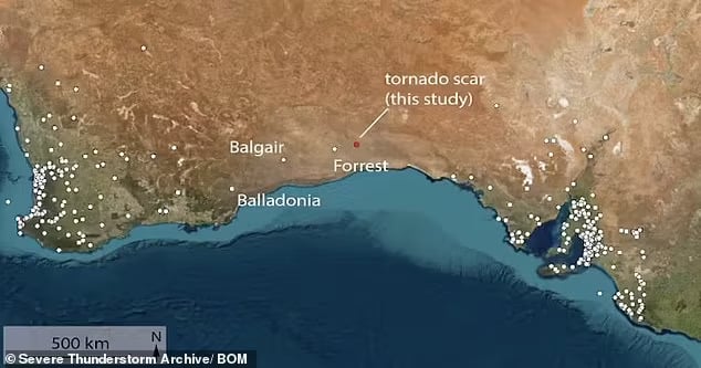
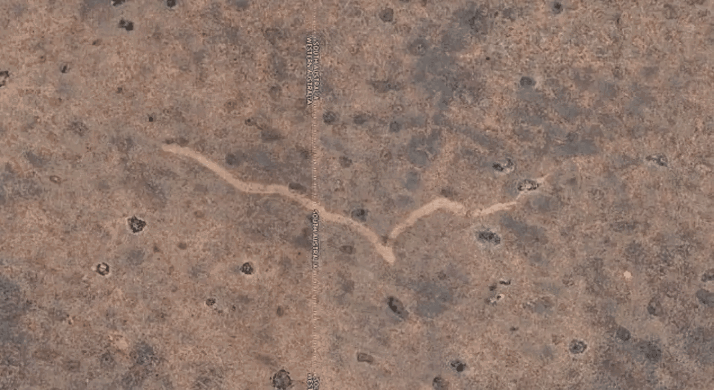
While exploring Google Earth, a caver examining the Nullarbor Plain—a vast, remote region in southern Australia—noticed an unusual feature. What appeared to be a mere blemish on the landscape was, upon closer inspection, an 11-kilometer-long and 250-meter-wide scar. This unexpected finding has captivated scientists and ignited new research into the area’s extreme weather events.
Dr. Matej Lipar, an adjunct research fellow at Curtin University’s School of Earth and Planetary Sciences, expressed his astonishment: “This scar was a remarkable find. Its sudden appearance was a real puzzle.” Situated about 20 kilometers north of the Trans-Australian Railway, the scar’s clarity and size prompted an expedition for further investigation.
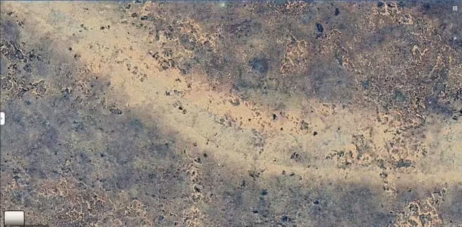
Upon reaching the site, Dr. Lipar and his team observed distinct cycloidal marks—patterns formed by tornado suction vortexes. These markings indicated that the tornado was likely an F2 or F3 on the Fujita scale, with wind speeds exceeding 200 kilometers per hour. The event, estimated to have lasted between seven and thirteen minutes, left a dramatic imprint on the landscape.